As an Amazon Associate, we earn from qualifying purchases. Some links on this site are affiliate links at no extra cost to you. Our recommendations are based on thorough research and editorial judgment.

Winter Weather Patterns in the Great Lakes Region: Monthly Breakdown
Winter weather in the Great Lakes region varies monthly. December often starts warm but can spike cold later, mixing rain, snow, and sleet. January sees significant lake-effect snow, particularly in areas like Michigan’s Upper Peninsula, where accumulations can exceed 100 inches. February typically features colder temperatures and more lake-effect events. Climate change affects these patterns, contributing to erratic weather and increased snowfall. Understanding these trends can help residents prepare for winter conditions. More insights follow.
Key Takeaways
- January features extreme temperature variations, with record highs and lows influenced by Arctic air masses across the Great Lakes region.
- February often brings intense lake-effect snow, delivering localized snowfall exceeding 2 feet, particularly along southern and eastern shores.
- December experiences notable temperature fluctuations, with averages above normal early in the month, transitioning to colder Arctic air spikes later.
- Lake-effect snow is prevalent in downwind areas, especially in regions like Michigan’s Upper Peninsula, accumulating over 300 inches annually.
- Climate change impacts winter weather patterns, causing a rise in average temperatures and increasing precipitation by 15% over recent decades.
General Weather Patterns in Winter
During winter, the Great Lakes region experiences significant weather variations that are influenced by both natural patterns and climatic changes. Temperature swings are common, defined by extreme cold events and occasional warm spells. January 2026 illustrated this variability, with temperatures ranging from nearly record highs to lows of -32°F in northern Wisconsin. Atmospheric shifts bring Arctic air masses, impacting local conditions and causing weather anomalies. These shifts often lead to rapid warm-ups or sudden cold snaps, making the winter landscape dynamic. As the region grapples with these fluctuations, the effects of climate change are evident, contributing to an increase of roughly 3°F in average winter temperatures since 1896. Such changes shape the winter experience for everyone in the area. Additionally, proper care and maintenance of winter gear is essential to ensure outdoor activities remain comfortable despite the harsh conditions.
Lake-Effect Snow Dynamics

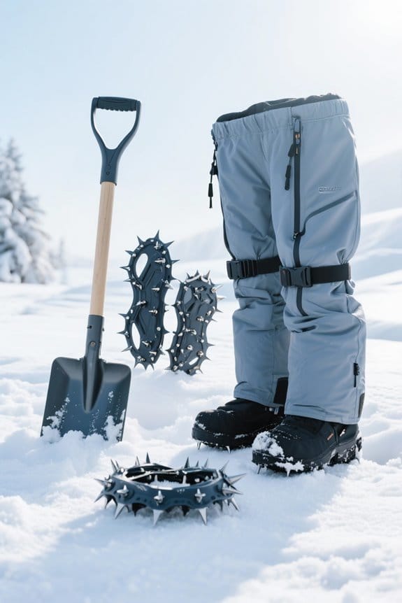
When cold, dry air moves over the warmer waters of the Great Lakes, lake-effect snow (LES) can develop. This phenomenon occurs when AR cold air masses absorb moisture and warmth from the lakes. The result is intense snow bands that may produce 2 to 5+ inches of snowfall per hour. Lake effect variations in snowfall intensity depend on several factors, including wind direction, temperature differentials, and local topography. Areas such as Michigan’s Upper Peninsula and the Tug Hill Plateau are known for their heavy lake-effect snow. Here, snowfall can exceed 300 inches annually. The unique conditions create localized heavy snowfall events, meaning some areas may be blanketed in snow while nearby spots remain clear. Understanding these dynamics can aid in winter preparations, especially when considering the use of snow gaiters for protection against the harsh winter elements.
Recommended Products
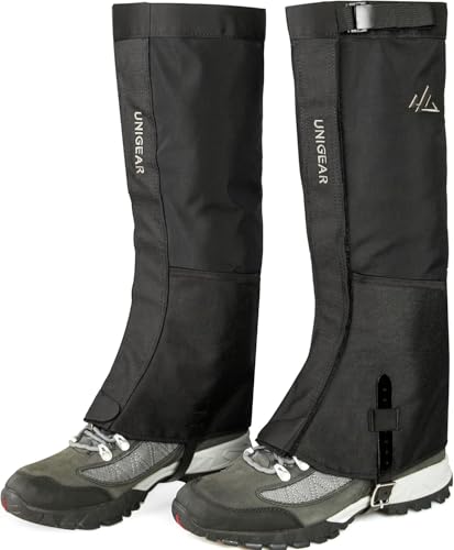
DURABLE: The upper part of gaiters are made of TASLON, typically lightweight and water vapor transmission. Comfort Breathability, breathable to sweat or water vapor. Moisture permeability level >8000/㎡.24hrs, it is helpful to keep your leg dry and comfortable. Different from normal Nylon material, Unigear gaiters choose 1000D Nylon on the low legs, which reinforce abrasion resistance and anti-tear

Our 16.5-inch tall gaiters create an impenetrable shield against snow, mud, and debris with 600D waterproof oxford fabric
DURABLE: The upper part of gaiters are made of TASLON, typically lightweight and water vapor transmission. Comfort Breathability, breathable to sweat or water vapor. Moisture permeability level >8000/㎡.24hrs, it is helpful to keep your leg dry and comfortable. Different from normal Nylon material, Unigear gaiters choose 1000D Nylon on the low legs, which reinforce abrasion resistance and anti-tear
Temperature Fluctuations in December

December brings notable temperature fluctuations across the Great Lakes region, influencing winter weather patterns considerably. This month typically sees temperature anomalies, with averages around 1.6°F above normal for maximums and 3.1°F above for minimums, especially in areas like Wisconsin. Early December tends to be warmer, while late-month conditions can produce spikes reaching record highs. However, Arctic air masses may still infiltrate, leading to sharp cold spells. The La Niña phenomenon plays a role, potentially causing cooler winter oscillations but showing notable variability. Regions near lakes often experience moderated temperatures due to warmer surface water, delaying freeze-up. Local geography, such as urban areas, can also create unique temperature experiences, contributing to December’s overall variability. Additionally, winter survival kits become essential as temperatures drop, providing crucial tools for safety during extreme conditions.
Precipitation Types in December

As winter settles in, precipitation types in the Great Lakes region shift markedly in December. During this month, residents experience a mix of snow, freezing rain, and sleet, driven by changes in temperature at different heights in the atmosphere. Lake-effect snow often dominates, especially in areas downwind of the Great Lakes. As December progresses, freezing rain becomes common, particularly due to warm air interacting with cold surfaces, leading to dangerous ice accumulation. Sleet formation can also occur, albeit less frequently. This happens when snowflakes partially melt, refreezing into ice pellets before hitting the ground. These diverse precipitation types showcase the complexities of winter weather in the region, reminding residents to stay informed and prepared for changing conditions. Keeping an emergency survival car emergency kit in your vehicle can help ensure safety during unexpected winter storms.
Major Storm Events in December

In the Great Lakes region, December often brings dramatic storm events that can substantially impact local communities. Major storm occurrences frequently drive snowfall averages well above the norm, particularly in areas downwind of the Great Lakes. For example, Cattaraugus, NY, received over 72 inches of snow between late November and early December 2026. Record levels were also reported in Erie, PA, which saw 22.6 inches in a single day. These events highlight a pattern of intense lake-effect snow, more common in December. Communities often brace for significant snow accumulations as these storms can exceed 15 inches in just a couple of days. Understanding these patterns helps local residents prepare for winter challenges and maintain safety during severe conditions. Additionally, the combination of moisture-wicking materials and insulation technology in thermal base layers is essential for staying warm during such extreme weather.
Recommended Products

All-Day Warmth: These long johns for men thermal lock in body heat for lasting warmth, keeping you comfortable through cold days as your reliable base layer all season long.

Midweight: Mens Merino Base Layer Available in: Lightweight = 165 g/m², Midweight = 250 g/m², Heavyweight = 320 g/m². Free Merino Wool Hiking Socks ($21 Value) – Package includes Midweight Merino wool base layer mens top and wool men long johns 250 g/m² + Merino Wool Hiking Socks. Cool Packaging. Makes A Great Gift.

All-Day Warmth: Lock in body heat and stay cozy all day. Lightweight yet snug, these long johns for women thermal deliver lasting warmth without the bulk—your ideal base layer for cold weather.
December Lake Ice Formation
The onset of ice formation in the Great Lakes marks an important change for the region’s winter weather. Typically, ice begins to form in the northern lakes as early as late November or early December. Initial ice forms mainly in shallow coastal areas, creating thin, localized patches rather than widespread ice coverage. This early December ice is often clear and crystalline, consisting of hexagonal plates and needles that grow nearshore. However, growth is generally slow, with lower lakewide coverage around 1-2% mid-month. Weather patterns, such as cold outbreaks, can briefly enhance local ice formation. Understanding December’s ice conditions provides valuable context for predicting future ice growth and lake behavior throughout the winter season, as well as the impact of thermal underwear options on outdoor activities in cold weather.
Cold Temperatures in January
January represents the coldest month in the Great Lakes region, characterized by frigid temperatures and frequent snowfall. With average highs often hovering around the low 30s°F and lows plummeting below 20°F, the January chill sets in, impacting daily life. Residents may face overcast skies and lake-effect snow, especially in areas near the lakes. Indoor activities become essential during this time. People often seek warmth through hobbies such as baking, reading, or crafting to stay cozy. While the lakes moderate temperatures somewhat, cold snaps still occur, reminding everyone that winter is firmly established. For outdoor enthusiasts, the chilly weather can still support activities like skiing and ice fishing when conditions permit, but preparation is key for safety and enjoyment. To stay warm during these cold months, consider investing in thermal underwear options that provide excellent insulation and moisture-wicking properties.
Arctic Air Intrusions in January
Frigid temperatures in January often signal the arrival of Arctic air intrusions in the Great Lakes region. These cold outbreaks, which can originate from Siberian air masses, lead to intense wind chill factors, sometimes plunging between -15 to -35°F. Meteorological characteristics of these intrusions include dry, stable air that creates clear skies and prolonged cold spells. While substantial snowfall may not always accompany these Arctic air masses, their impact on energy demand is significant, as heating needs surge during this time. Additionally, infrastructure faces threats from freeze damage, including burst pipes and stressed power grids. As Great Lakes ice coverage expands rapidly during these intrusions, awareness of their effects remains crucial for residents in the community.
Recommended Products

YOU'LL RECEIVE: 12 pcs 15.7 inch, 0.6" pipe insulation, the total length of the pipe insulation is 15.74 ft, the inner diameter is 0.6 in and the thickness is 0.4 in, it can be cut to fit different lengths of pipes as needed

❄【High Compatibility】-- Faucet covers for winter measures 6.7" W x 8.3" H, Works well with various faucet types, such as garden spigots, hose bibs, water tap, keep faucets protected in freezing weather.

Save Costly Pipe Repairs: Every winter, many people complain that despite the time they spend wrapping towels and tape around their pipes, the pipes break and leak, and even cost a lot of money to repair. But with this backflow insulation cover, you don't have to spend so much money again. Don’t wait before it’s too late
Snowfall Records in January
Snowfall records in January illustrate the varied winter climate across the Great Lakes region. Historical snowfall totals show significant differences by location. For instance, Michigan cities can see totals from 2 inches in Monroe County to more than 100 inches in parts of the Upper Peninsula. The Tug Hill Plateau is famous for its lake-effect snow, recording impressive amounts over a few days. This phenomenon can dramatically affect local conditions, making travel challenging. Additionally, recent January events highlight the snowfall impact, such as the 33.7 inches Chicago experienced in 2014. Understanding these snowfall records helps communities prepare for winters and appreciate the region’s unique weather patterns. It is important for winter adventurers to equip themselves with essential avalanche safety gear to ensure safety during severe weather conditions.
Persistent Winter Patterns in February
As winter progresses, February often brings distinct weather patterns that shape the Great Lakes region. During this month, air temperatures frequently drop below normal, signaling the return of winter cold. February anomalies can create substantial negative temperature shifts, especially over the western parts. This drop fosters notable ice cover trends, leading to increased ice growth on Lakes Superior, Huron, and Michigan. Lake Erie usually experiences sharp ice increases early in the month. Notably, some recent years have seen warm Februaries, creating contrasts in ice cover data. As the month progresses, it typically becomes a significant time for ice coverage, with many lakes reaching over 90% ice cover, vital for shoreline protection against winter storms. In these conditions, the importance of proper snow removal techniques becomes evident to ensure safe access and minimize hazards.
February Lake-Effect Snow Events
February often brings some of the most notable lake-effect snow events to the Great Lakes region. During this month, intense snow bands shape the weather, particularly along the southern and eastern shores. Lake effect statistics highlight that snowfall can exceed 2 feet in localized areas. For instance, the Tug Hill Plateau often sees over 20 feet of snowfall each February, with some events producing rates over 3 inches per hour. Limited lake ice enhances these conditions, allowing for significant moisture transfer. Consequently, areas near Lake Ontario, like Oswego County, can experience multi-day events that result in exceptional snowfall totals, exemplifying the region’s unique winter weather patterns and the fascinating dynamics of February snowfall. Additionally, understanding lake-effect snow events can help residents prepare for the heavy snowfalls that characterize this month.
Recommended Products

SNOW SHOVEL AND SHOW PUSHER: 18-in combination blade shape is ideal for shoveling and pushing snow

Ideal accessory for motorists and outdoor enthusiasts who like to be prepared for anything

Buddy B Children'S Shovel Looks Just Like Mom And Dad'S
Regional Variations in Winter Weather
Regional variations in winter weather across the Great Lakes are influenced by multiple factors, including geography, temperature gradients, and prevailing wind patterns. Northern regions, like the Upper Peninsula of Michigan, face stark temperature variances, with January averages as low as -9°F. In contrast, southern areas, such as Ohio, see milder temperatures between 20°F and 30°F. Snowfall disparities are particularly distinct as well. While southern Indiana receives less than 20 inches of snow annually, the northern parts experience over 200 inches, especially near the lakes due to lake-effect snowbands. Urban heat islands in cities like Chicago slightly soften harsh winters, and nighttime inversions create colder pockets in valleys, showcasing the diverse winter weather experiences across this iconic region.
Climate Change Effects on Winter Weather
Climate change is reshaping winter weather in the Great Lakes region, leading to noticeable changes in temperature, ice coverage, and precipitation. Since 1951, average winter temperatures have risen nearly 3°F, markedly outpacing other U.S. regions. This warming results in less harsh winters and reduced ice cover, with ice duration shortening by almost a month. Such climate variability trends alter snow patterns, with more intense but erratic lake-effect snow events. Additionally, winter precipitation has surged by 15%, causing severe storms and rapid temperature swings. The increasing frequency of these events highlights the greenhouse gas impacts on local weather, urging residents to adapt to uncertainties in winter conditions while fostering community awareness about these notable changes.
Future Projections for Great Lakes Winters
As winter approaches, projections for the Great Lakes region indicate significant changes ahead. Average winter temperatures are expected to rise by 3°F to 5.8°F by mid-century, leading to milder winters. By 2100, this increase could reach as much as 11.4°F. Alongside this, precipitation variability may increase, resulting in erratic winter conditions. Areas may see shifts in snowfall patterns, with potential increases in lake-effect snow due to reduced ice cover. While some regions might experience record snowfall, overall trends suggest both reduced cold days and more extremely warm days. These changes could alter winter activities, prompting families to prepare for a different seasonal experience in the Great Lakes. Community awareness will be essential for adapting to these shifts.
Frequently Asked Questions
How Do Winter Weather Patterns Affect Local Economies in the Great Lakes?
How can winter weather patterns not influence local economies in the Great Lakes? Economic resilience hinges on reliable snowfall; seasonal employment in tourism flourishes or falters based on winter conditions, impacting community stability and connection.
What Impact Does Winter Weather Have on Wildlife in the Region?
Winter weather challenges wildlife adaptation, forcing species to modify foraging strategies. Increased snow limits food access, leading to heightened energy demands. Many animals rely on specialized behaviors and survival tactics to endure harsh seasonal conditions.
How Does Urban Infrastructure Cope With Winter Weather Challenges?
In the spirit of Frost’s quiet resilience, urban infrastructure employs efficient snow removal strategies alongside robust heating systems, ensuring communal safety amidst winter challenges, while fostering a shared sense of belonging in the face of harsh conditions.
What Are the Common Myths About Winter Weather in the Great Lakes?
Common myths about Great Lakes winter weather include misconceptions about ice fishing opportunities and snow accumulation. Understanding these myths fosters community awareness, encouraging residents to embrace the region’s shifting climate and participate in seasonal activities together.
How Do Winter Weather Patterns Influence Tourism Activities in the Area?
Winter weather patterns substantially influence tourism activities, with a 25% decrease in snow impacting ski tourism and seasonal festivals. As conditions become less reliable, communities confront economic challenges and the need for adaptive strategies in recreational offerings.